Saturday’s a good day for voting
Hello Friends, It’s a day to do one’s civic duty (assuming you haven’t already done so) and maybe, possibly, even get a little wave at some point too. As of midnight the MHL buoy off Sydney was showing 2 metres of 8-sec south wind bump. The wind was offshore and as the day goes along […]
Not interesting

Hello Friends, 10-15kts of SSE wind, south swell of 2 metres at 8 seconds and an incoming tide to a high at 1025 adds up to nothing of interest at Dee Why this morning. Throw in the occasional drizzle period and mainly cloudy skies and it’s looking like a day to be at work or […]
That’s not very nice Huey
Hello Friends, Good day for Sydneysiders to tack into Christmas preps because the beach is forgettable in a big way. Stiff southerly blowing the tops off a trashed and gutless south wind swell. And it’s set to go SE later. Honestly, the less said about today the better. So, thoughts turn to tomorrow, and here […]
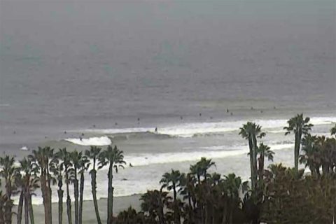
Sunny and SE
Hello Friends, Cool and breezy from the southerly quarters on this sunny Sunday morning in Sydney. The swell is out of the south at a couple metres with a period of 8 seconds. We’re talking wind swell obviously, so the waves are going to be biggest at spots most affected by the steady 8-10 kt […]
Picking up
Hello Friends, Swell is out of the south at about two metres on average with a period of 8 seconds. Wind was 10-15 kts WSW at a little before 0700. Skies started out largely cloud free over Sydney too. Tide is dropping to a low at 1120 and will be back to high at 1755. […]
A few small waves about this morning
Hello Friends, The Bureau is expecting a metre of easterly swell, but the MHL buoy this morning is reporting straight south wind swell of a couple metres and an average period inching toward the 8 second mark. It was glassy early on and Dee Why point was picking up the odd set into the chest […]
All she wrote
Hello Friends, Have a look at the MHL data for Sydney (below) and you can see why this morning is back to small (but not absolutely flat) again. At lunch time yesterday the swell was almost east at two metres, now it’s dead south. But more importantly, the period slumped from a juicy 14sec to […]
Rain early, swell on the fade
Hello Friends, From the look of the radar this morning, we’re in for another bout of rain before it clears up. There are still some little waves to be had, but it looks as though the swell’s not going to deliver as the models were predicting a day or two ago. It’s gone around to […]
Hello Friends, Radar showing a few showers around as Sydney sets off on Monday. Swell has gone back to the south and is a couple metres at sea, but the period’s a marginal looking 8 seconds. Throw in 20 kts of NE’r already and it has the look of a day with restricted surf options. […]
Rainy, thundery morning
Hello Friends, Gee, I hope to be proven wrong, but this winter seems to be following the pattern of last year, ie, great start but fizzling into ordinariness by August. I’ve got to wait for the rain to lift before I can get a snap, but from the way it looked through the murk, not […]