Sunday swell
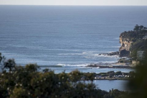
Hello Friends, Dee Why point and beach were already well populated at 0700 thanks to a set of near perfect conditions. Wind was light from the WNW and the SSE swell was around 2 metres at about 10 seconds Sets at the point were into the head high range on the bigger ones and it […]
Thumping swell and bigger tomorrow
Hello Friends, Now that’s annoying. Went out and shot pics at a heap of spots for you this morning only to get home and find the memory card had carked utterly and completely. So they’re off to pixel heaven and you’re none the wiser. Sorry, but will just have to make do with the crowsnest […]
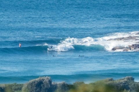
Monday waves looking fun early
Hello Friends, Swell is fading but this morning’s early session saw close to 2 metres of 10-second SSE swell, minimal wind and sunny skies. Set wave faces at Dee Why ranged from shoulder plus on the biggest ones at the point to head and a bit on the beachy bombs. School holidays are delivering reasonable […]
Brief window of opportunity Saturday morning
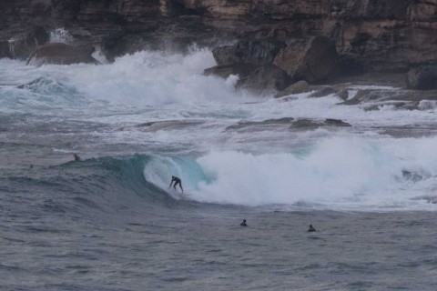
Hello Friends, Swell’s dropped significantly from yesterday, but exposed spots were still showing head high plus wave faces on the bigger ones. Surface conditions were comparatively smooth and less lumpy than yesterday – but it’s still pretty raw looking. Dee Why point was the best of the bunch when I looked. There were waves at […]
Monday morning waves

Hello Friends, Chilly tinge to the air at 0730 but wide blue skies overhead and 2 metres of 10-sec SSE swell rolling in for the first shift. Sets at Dee Why point were around the chest mark and similar, if not a bit bigger along the beach. Wind was a 10kt westerly and tide dropping […]
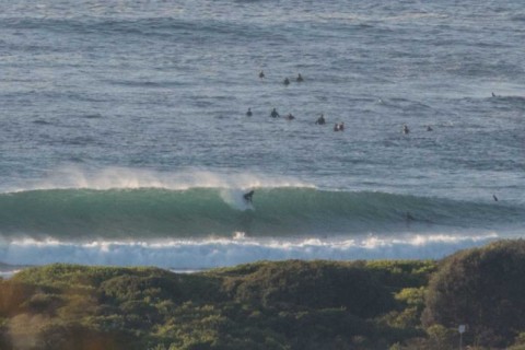
Waves for the early and more to come
Hello Friends, The Bureau’s hoisted a warning for large and powerful surf conditions later today. As of 0630 the swell was showing from the SSE at a couple of metres with an average period around the 10 second mark. Wind was light offshore for the dawn patrol and set wave faces at Dee Why beach […]
Signs of activity
Hello Friends, Interesting combo of short period NE wind chop and a SSE swell. According to the MHL data, the SSE is close to a 2 metres at 10+ seconds, but looking at Dee Why this morning, there’s minimal evidence of the south component. Kinda weird. Wind at the RealSurf crows nest as of 0700 […]
Sunday surfday
Hello Friends, A touch bigger than I’d expected for this morning. Sunny skies and light NW winds are combining with a couple metres of 10 second period SSE swell to deliver the odd head high set along the beach at Dee Why. The point seemed much less consistent and smaller. There should be […]
Drizzle but glassy and the swell continues early
Hello Friends, Dull skies, drizzle and a wintry chill to the air, but there were waves as of 0900 thanks to 2 metres of 10 second period SSE swell. Those numbers are exactly right for lots of places in Sydney, so if you’re keen to get in, there should be opportunities to hand. The wind […]
Still pumping on Monday morning
Hello Friends, Did you get in the water over the weekend? The swell didn’t quite go ballistic in the way the models (and the Bureau for that matter) said it would, but it wasn’t exactly small either. This morning sees the swell down a bit since yesterday afternoon, but it looks much cleaner […]