


Hello Friends,
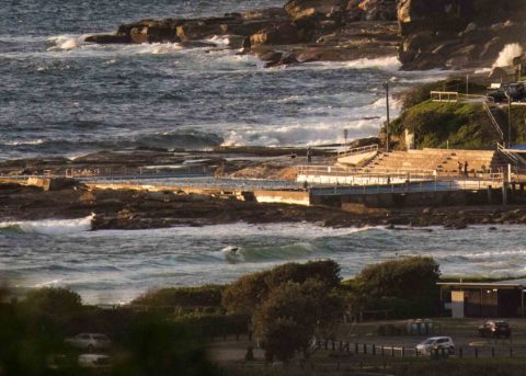
Wind was 10-15kts from the ESE at 0745. It’s set to go around to the S-SE soon and the swell is expected to continue at the present low intensity through the day. At 0500 it was 1.6 m out at sea and coming from the ESE at a weak 7 seconds apart. It’s too small to produce anything at the point but as one of the pictures shows, there were occasional knee high bump to be found among the slop and confusion. Tide is low at 0800 and the high will be along at 1355 when it will be a moderate 1.27 m. Ocean is 23°C.
Today’s Goat’s forecast day, so I’ll defer to his excellency on the question of our prospects for next week. He usually pushes it out mid afternoon, so check back later for your weekly dose of Goatly wisdom!
Have a top old day one and all.
Weather Situation
A high pressure system over Tasmania extends a ridge into the Tasman Sea, and is directing predominantly southeasterly winds along the New South Wales coast. This pattern will change very little during the next day or two as the high edges slowly east, to be centred over the southern Tasman Sea by Friday. The southern half of the coast will see a gradual shift to northeasterly winds as the high moves away, before a trough brings a southerly change after the weekend.
Forecast for Thursday until midnight
- Winds
- South to southeasterly 10 to 15 knots.
- Seas
- Around 1 metre.
- Swell
- Southeasterly 1 to 1.5 metres.
- Weather
- Cloudy.
Friday 9 March
- Winds
- Southeasterly 10 to 15 knots.
- Seas
- Around 1 metre.
- Swell
- Southeasterly 1 to 1.5 metres.
- Weather
- Partly cloudy. 60% chance of showers.
Saturday 10 March
- Winds
- Southeasterly 10 to 15 knots becoming easterly about 10 knots during the evening.
- Seas
- Below 1 metre.
- Swell
- Southeasterly 1 to 1.5 metres.
- Weather
- Partly cloudy.


