Hello Friends,
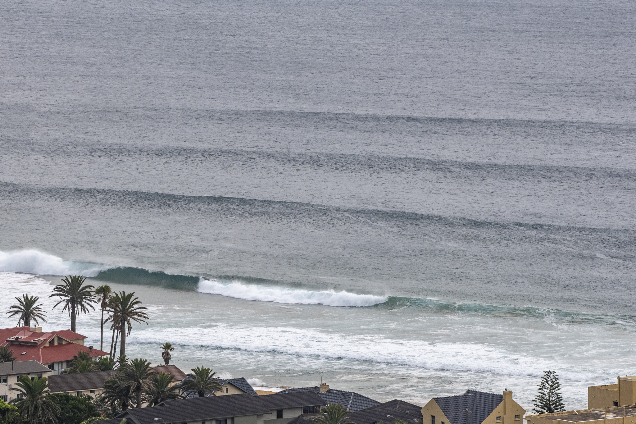
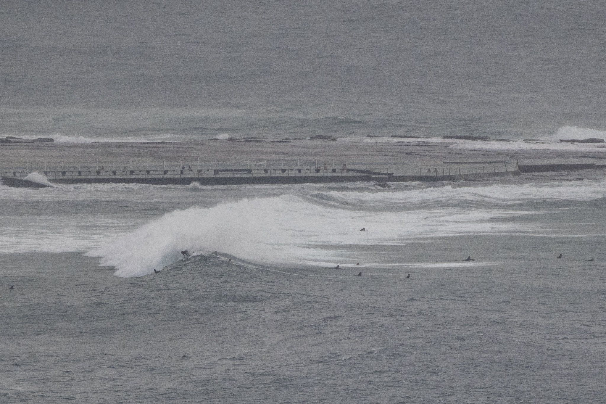
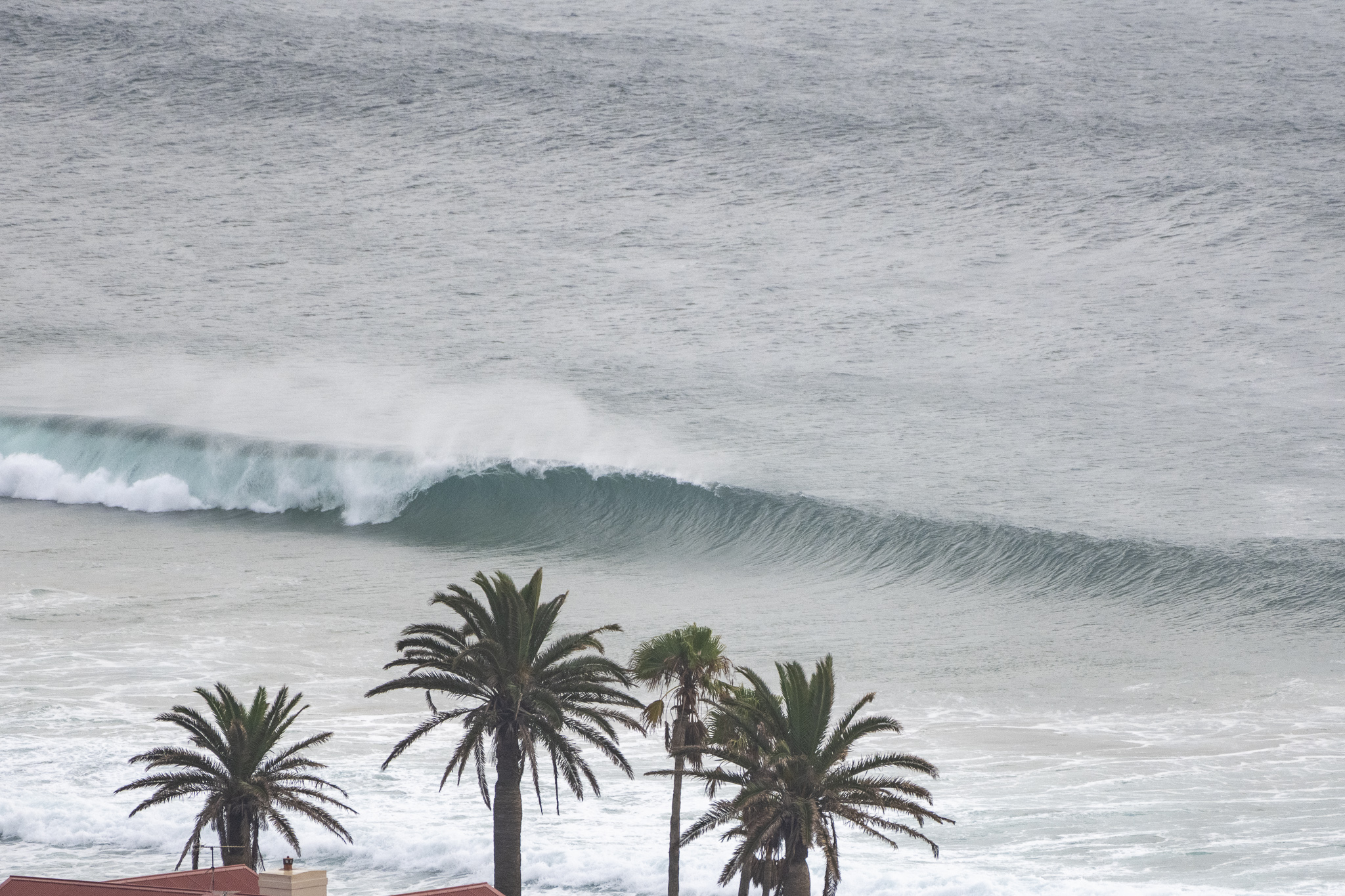
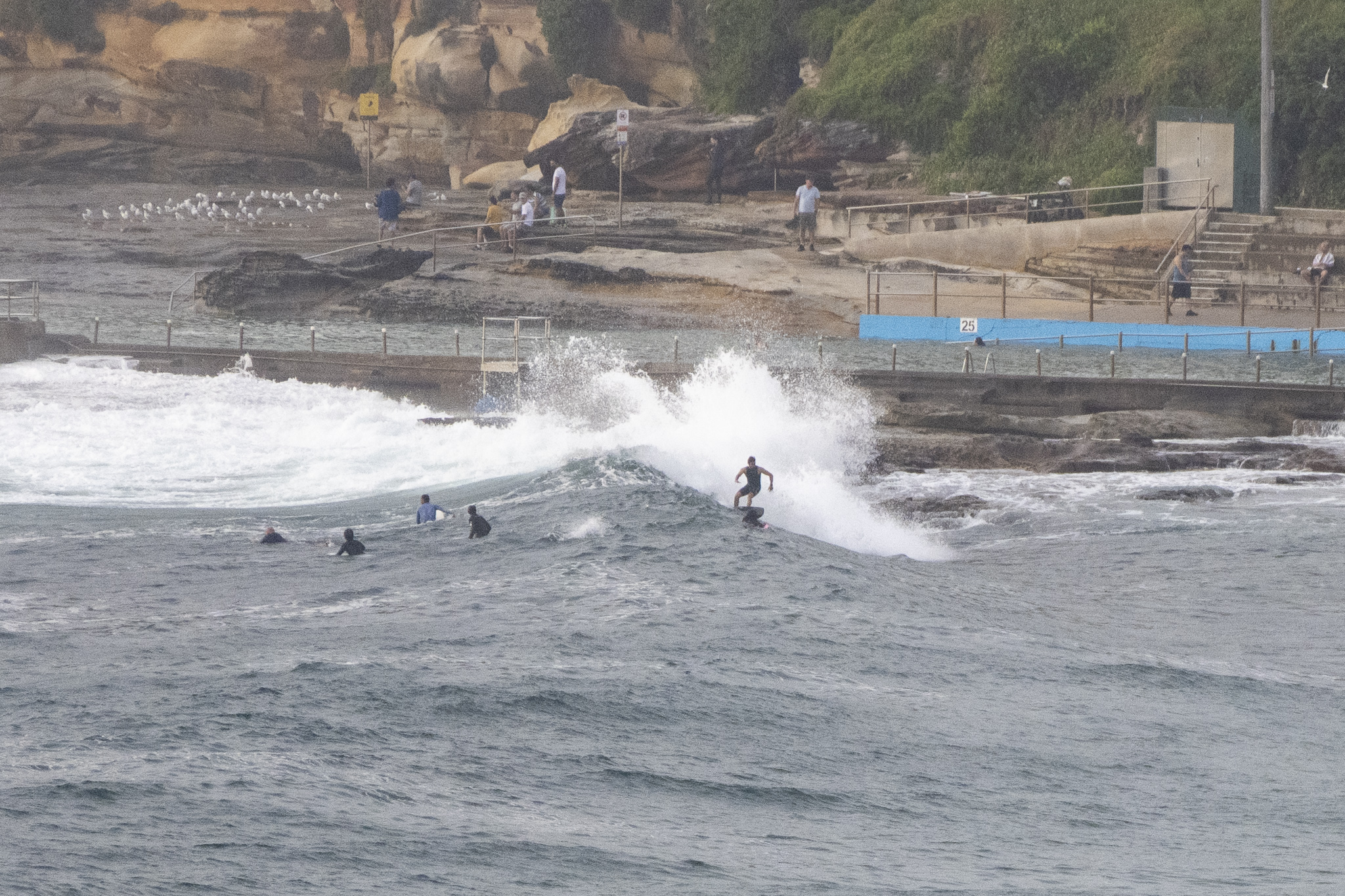
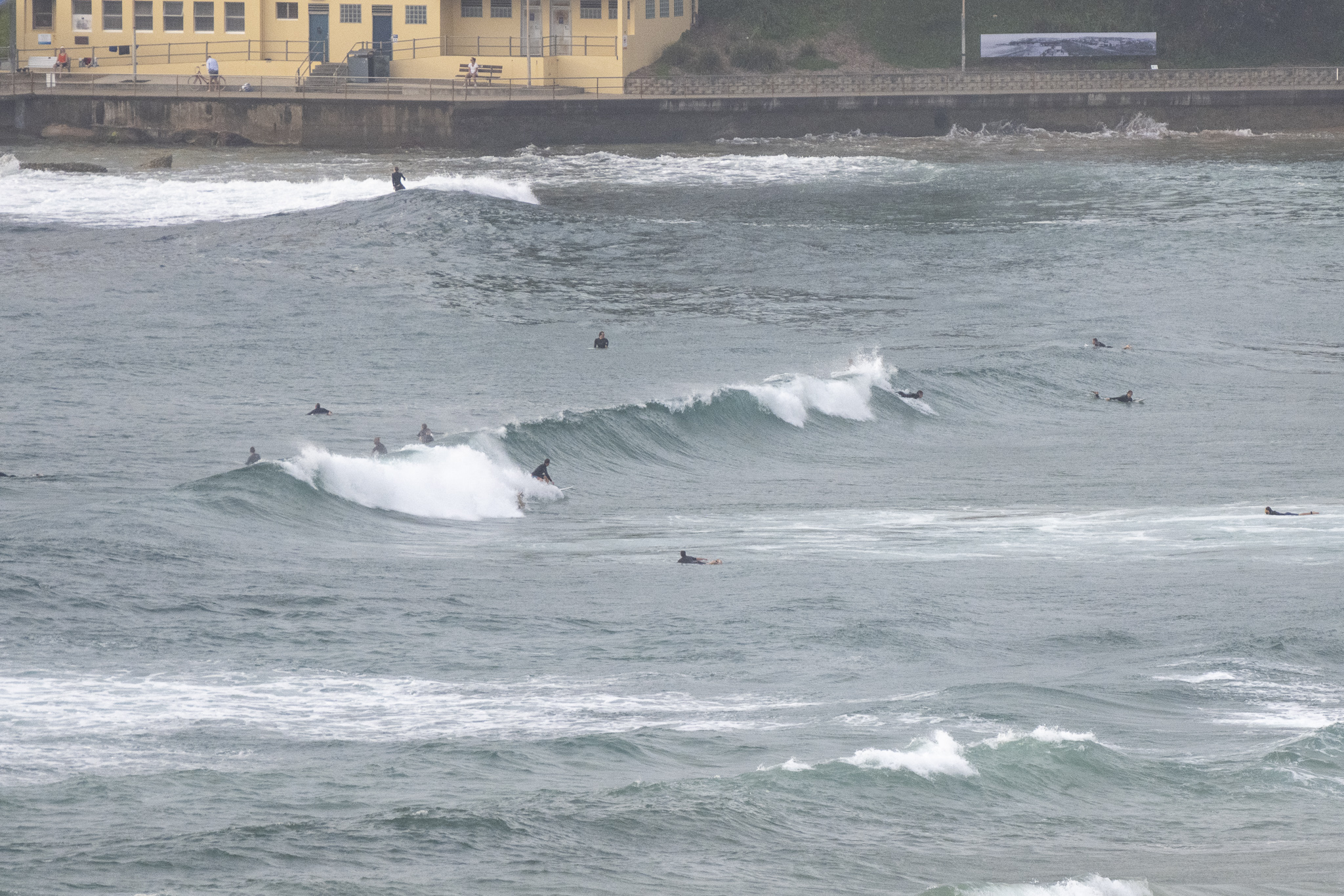
Wind turned WSW around 0300 and by daybreak it was SSW at 10-20 kts which, as the pictures show, meant the south ends were looking pretty clean. Swell was coming from the east and still chuffing along at 13 seconds apart and nearly 2 metres at sea. The bigger sets were into the shoulder-head high range, but mostly it was more waist to chest. Skies were gloomy and low, which is entirely consistent with the forecast of an 80% chance of showers and accumulations into the 15mm range being possible.
The cloudy, showery weather is set to continue but tomorrow there’s a strong wind warning for 20-30 kts of southerly going SE’ly. Swell should still be around but the longer period east will be getting lumped up by the short period south stuff arriving with the wind. And Thursday looks, if anything, even less interesting as wind hammers in from the SE at 20-30 kts and the longer period east fades out as the south wind swell fills in. Beyond that, I didn’t see anything too exciting on the models when I gave them a quick glance. Basically looks like relentless onshores and short-period south wind bump through the weekend. Hope to be proven wildly wrong!
Stay safe folks and keep an eye out for RATs as we’re told the supplies should start turning up in coming days.
Weather Situation
A high pressure system over the Tasman Sea is directing northerly winds along much of the New South Wales coast while a southerly change is moving slowly up the central coast. The change will move further north today and Wednesday and the another high to the south of the Great Australian Bight strengthens. Fresh to strong southeasterly winds are then forecast to persist for the remainder of the week.
Forecast for Tuesday until midnight
- Winds
- North to northeasterly 10 to 15 knots shifting south to southwesterly 15 to 25 knots during the morning. Winds reaching up to 30 knots offshore in the evening.
- Seas
- Below 1 metre, increasing to 1 to 1.5 metres around midday.
- Swell
- Easterly 1.5 to 2 metres, decreasing to 1.5 metres by early evening.
- Weather
- Cloudy. 80% chance of showers. The chance of a thunderstorm offshore.
Wednesday 19 January
Strong Wind Warning for Wednesday for Sydney Coast
- Winds
- Southerly 20 to 30 knots turning southeasterly 25 to 30 knots in the late morning and afternoon.
- Seas
- 1.5 to 2 metres, increasing to 2 to 3 metres during the morning.
- 1st Swell
- South to southeasterly 1 to 1.5 metres.
- 2nd Swell
- Easterly 1 to 1.5 metres, decreasing to around 1 metre during the afternoon.
- Weather
- Cloudy. 80% chance of showers.
Thursday 20 January
- Winds
- Southeasterly 20 to 30 knots.
- Seas
- 1.5 to 2.5 metres.
- Swell
- Southeasterly 2 metres.
- Weather
- Cloudy. 50% chance of showers. The chance of a thunderstorm


