Surf forecast issued Thursday 31 August 2023: Seven day outlook for Sydney
There’s currently a High in the Bight, and a Bite in the High.. An East Coast Low seems to be spawning off the South Coast according to the BoM.. Doesn’t look like it will last long at this stage but Lows do their own thing sometimes…
Assuming it does what the BoM expects, there ‘ll be some windy days, and some waves, but the quality will depend on the winds and the swell direction, which depend in part on the Low’s movements.. Lots of variables for Mother Nature to play with.
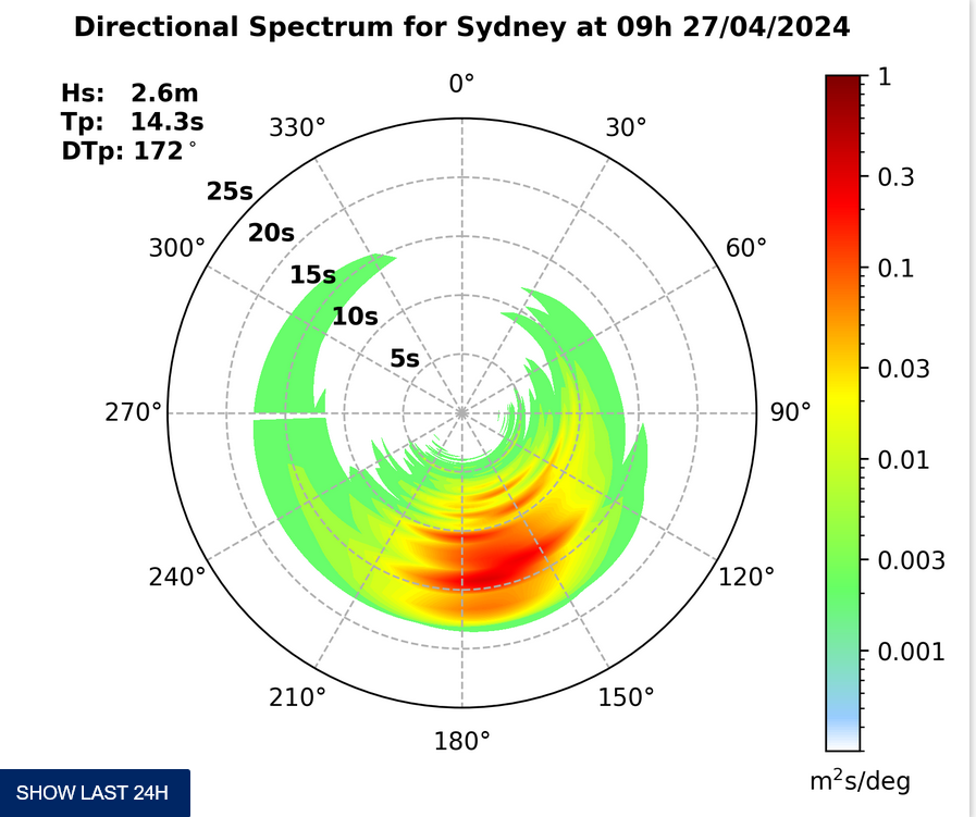
TG thinks the Surf Outlook after today’s tinyness, should be something like this~~~~~~
Friday: starting to come up at places open to dead South. say 1, 1+, 1-2 metres or more as the forecast Southerly wind strengthens later
Saturday: around 2 ish metres or more – with wind – at dead South spots, then easing back a bit into the 1-2 metre range South East – with wind
Sunday: easing back thru the 1-2 metre range East South East, with a bit of onshore later
Monday: say 1-2 metres East
Tuesday: around 1 – 1+ metres North East
Wednesday: rising thru the 1-2 metre range South East
Thursday: around 1-2 metres at places open to dead South.
TG
Up in the Air

http://www.bom.gov.au/australia/charts/4day_col.shtml


Winds
https://www.windy.com/-33.850/151.220?-34.368,151.221,8
Down in the Sea
Water temp is around 18

Tides
https://www.nsw.gov.au/sites/default/files/2023-06/nsw_tides_2023%E2%80%932024.pdf
Weather from the Bureau
Forecast issued at 4:20 pm EST on Thursday 31 August 2023.
Forecast for the rest of Thursday
- Summary

- Mostly clear.
- Chance of any rain: 20%

Sydney area
Partly cloudy. Slight chance of a shower, mainly near the coast. Winds southeasterly 15 to 20 km/h becoming light in the evening.
Sun protection recommended from 10:00 am to 1:50 pm, UV Index predicted to reach 4 [Moderate]
Friday 1 September
- Summary

- Min 10
- Max 18
- Becoming windy. Partly cloudy.
- Chance of any rain: 20%

Sydney area
Partly cloudy. Slight chance of a shower along the coastal fringe, most likely in the morning. Winds west to southwesterly 15 to 20 km/h turning southerly in the late morning then increasing to 30 to 45 km/h, then decreasing to 15 to 20 km/h in the late evening.
Fire Danger – Moderate
Sun protection recommended from 9:50 am to 2:00 pm, UV Index predicted to reach 4 [Moderate]
Saturday 2 September
- Summary

- Min 10
- Max 18
- Partly cloudy.
- Chance of any rain: 10%

Sydney area
Partly cloudy. Winds southwesterly 15 to 20 km/h turning south to southeasterly 15 to 25 km/h in the morning then becoming light in the evening.
Sun protection recommended from 9:40 am to 2:00 pm, UV Index predicted to reach 4 [Moderate]
Sunday 3 September
- Summary

- Min 9
- Max 19
- Partly cloudy.
- Chance of any rain: 5%

Sydney area
Partly cloudy. Light winds becoming easterly 15 to 20 km/h during the afternoon then becoming light during the evening.
Sun protection recommended from 9:40 am to 2:00 pm, UV Index predicted to reach 4 [Moderate]
Monday 4 September
- Summary

- Min 10
- Max 22
- Mostly sunny.
- Chance of any rain: 5%

Sydney area
Sunny. Light winds becoming northeasterly 20 to 30 km/h during the day then tending northerly 15 to 20 km/h during the evening.
Tuesday 5 September
- Summary

- Min 13
- Max 26
- Sunny.
- Chance of any rain: 10%

Sydney area
Sunny. Light winds becoming west to northwesterly 15 to 25 km/h during the day.
Wednesday 6 September
- Summary

- Min 13
- Max 21
- Partly cloudy.
- Chance of any rain: 10%

Sydney area
Partly cloudy. Light winds becoming easterly 15 to 20 km/h during the day.
Thursday 7 September
- Summary

- Min 11
- Max 24
- Mostly sunny.
- Chance of any rain: 10%

Sydney area
Partly cloudy. Light winds becoming north to northeasterly 15 to 20 km/h during the day.


