
Hello Friends,
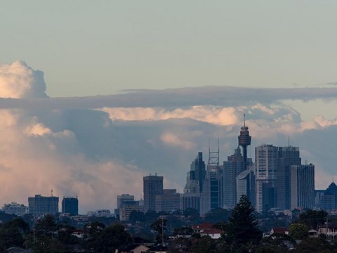
Ample sunny breaks over Sydney at around 0700, but lots of cloud off to the south and an 80% chance of showers later. Wind was light and offshore too, but by midday the Bureau says the southerly will be around the 20 kt mark and later it’ll be 25-30 kt.
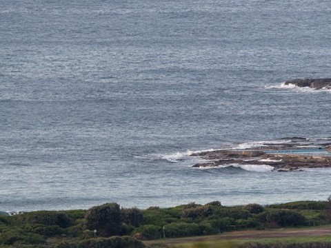
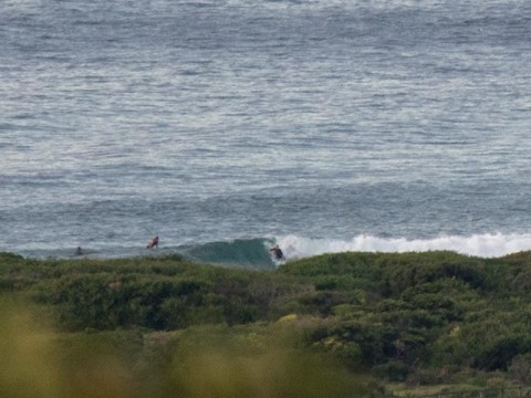
There were a few knee high little things coming into the beach at Dee Why, but the 1.3 metres of 7-second NE wind swell is making no impression on the point.
Today’s strong wind warning is expected to be a gale warning tomorrow as the southerly reaches 25-35 kts. On Tuesday it goes harder still (35-45 kts by evening).
The wind and rain will be accompanied by some pretty big and messy swell conditions. The models are picking the peak to be somewhere around Wednesday morning with some predicting up to 5 metres at the exposed spots. Depending on what the low does, the energy could be coming from the SE and if that’s the case there might be something in a protected south corner… but I’m not expecting approachable conditions before Friday – and then the water quality will likely be an issue.
Have a great Sunday one and all!
Weather Situation
A slow-moving high pressure system over the Tasman Sea is maintaining a ridge towards southeast Queensland, while a trough lies over inland NSW. A cold front will move a long the the coast today with strong south to southwest winds extending over southern and central waters. A low pressure system is likely to form off the Hunter or Mid North Coast on Monday then intensify Monday night/Tuesday with further strong to gale-force winds along much of the coast and increasing swell.
Forecast for Sunday until midnight
Strong Wind Warning for Sunday for Sydney Coast
Winds
West to northwesterly 10 to 15 knots shifting southwest to southerly 20 to 25 knots in the morning, then tending southerly 25 to 30 knots during the afternoon.
Seas
1 to 2 metres, increasing to 2 to 3 metres around midday.
Swell
South to southeasterly below 1 metre.
Weather
Cloudy. 80% chance of showers.
Monday 20 April
Gale Warning for Monday for Sydney Coast
Winds
Southerly 25 to 35 knots.
Seas
3 to 4 metres.
Swell
Southerly around 1 metre, increasing to 1.5 to 2.5 metres during the day.
Weather
Cloudy. 90% chance of rain. The chance of a thunderstorm.
Caution
Large and powerful surf conditions in the afternoon and evening are expected to be hazardous for coastal activities such as crossing bars by boat and rock fishing.
Tuesday 21 April
Winds
Southerly 30 to 40 knots turning southwesterly 35 to 45 knots during the evening.
Seas
5 to 7 metres.
Swell
South to southeasterly 1.5 to 2 metres.
Weather
Cloudy. 90% chance of rain.
Caution
Large and powerful surf conditions are expected to be hazardous for coastal activities such as crossing bars by boat and rock fishing.


