
Hello Friends,
A seasonally cool day coming up – at last – with up to 20mm of rain and 20-30 kts of southerly to go with it. As the Goat foretold, the wind has pushed up the swell pretty dramatically overnight and as of 0500 the MHL buoy was showing 3.5 metres of 8-second straight south wind swell. Our first tide of the day is a high at 0855, so there’s that too.
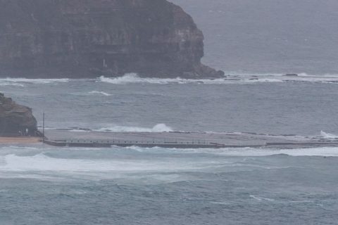
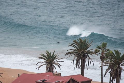
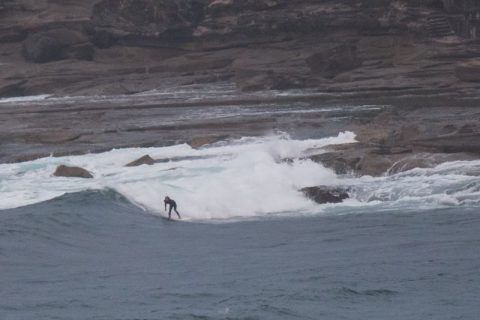
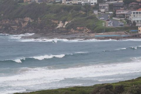
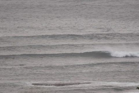
Conditions were comparatively smooth still at 0700 at Dee Why point and just inside along the beach. But the further you went up the beach, the more the wind was ripping it up. Set wave faces were in the chest plus range at the point. Although the period’s pretty short, there was some small activity getting around the corner into Whiterock, but I’m not sure it’s really surfable. Faces looked to be around the chest mark. Relatively clean surface conditions up to about the Marquesas for the early, and the swell was getting into it as well. Unfortunately there are no banks to speak of and waves are basically unloading within about 20 metres of shore. Northy was not looking inviting at all it has to be said. Not really surprising…
Outlook for the holiday weekend’s not too flash. The southerly is expected to go hard today and only throttle back a touch tomorrow. Worse, the dominant direction is set to be more SE by then. Weather should be nicer though. Monday we can expect more SE wind but the Bureau is predicting that it’ll be easing during the day. Swell heights will follow the wind velocities down, but according to the models there should be a chance of shoulder plus on sets pretty much all week. The issue will be the wind and it looks like the best laid plans will involve being up and at ’em early.
Weather Situation
A persistent southerly airstream is expected along the New South Wales coast today in the wake of a cold front which moved through far north coast overnight. A secondary southerly surge will bring strong winds to the southern and central coast, reaching gale force over the far north coast this afternoon. Winds will gradually turn southeast to northeasterly during Sunday and Monday as a high pressure system moves over the southern Tasman Sea .
Forecast for Saturday until midnight
Strong Wind Warning for Saturday for Sydney Coast
Winds
Southerly 20 to 30 knots.
Seas
2 to 3 metres.
Swell
Southerly 1 to 1.5 metres, increasing to 2 to 3 metres during the morning.
Weather
Partly cloudy. 70% chance of showers. The chance of a thunderstorm offshore early this morning.
Caution
Large and powerful surf conditions during the day are expected to be hazardous for coastal activities such as crossing bars by boat and rock fishing.
Sunday 24 April
Winds
Southeasterly 15 to 20 knots.
Seas
1 to 2 metres.
1st Swell
Southeasterly 1.5 to 2.5 metres, tending southerly around 1 metre later in the evening.
2nd Swell
Easterly around 1 metre.
Weather
Mostly sunny. 40% chance of showers in the morning.
Monday 25 April
Winds
Southeasterly 10 to 15 knots tending easterly below 10 knots during the day.
Seas
Below 1 metre.
Swell
Easterly 1.5 metres.
Weather
Partly cloudy.


