Micro morning
Hello Friends, Headed for a very hot day across Sydney and as so often seems to happen, the waves have pretty much gone away. Swell had dropped to about a metre of 12-sec SSE by 0400 and looking at it in the last hour, I’d say it’s weakened further. I couldn’t see anyone in the […]
Southerly smashing it on Sunday
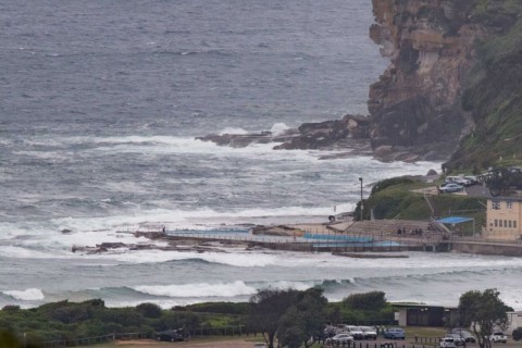
Hello Friends, Usual lazy Sunday start for your correspondent. Climbed up to the crows nest just on 0900. Wind was coming vigorously from the south at 20-25 kts under grey skies. Tide’s coming up to high at 1020. The MHL buoy was picking up 2.8 metres of 7-sec south to SSE wind swell at 0600. […]
Silvery start but still tiny

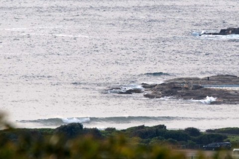
Hello Friends, No point looking at Dee Why with surf lust this morning. It is close to lake like in its stillness and inactivity. Every now and then a tiny and surprisingly feisty looking ankle high little line folds over on the sand, but really, you’d be scratching around elsewhere for something micro to catch. […]
Still small
Hello Friends, You could ask for better. But, then again, it is summer, so whadya expect? We’re in for a warm one again today – although out here on the coast will be nothing like the sort of heat pretty much everybody west of us to the Indian ocean’s had to put up with. With […]
Micro Sunday
Hello Friends, I wish the Bureau’d been wrong about this morning, but here we are with just over half a metre of east showing faintly on the 0500 directional spectra data from MHL. A reasonable number of hopefuls bobbing about on a warm and sunny morning at Dee Why, but apart from something in the […]
Could do better Huey
Hello Friends, Wind was working it over pretty thoroughly as the day got started in Sydney. We had a couple of metres of 10 sec period south swell, so had the conditions been better, you’d have found a wave. But instead, it’s trashed and unappetizing in the extreme. Weirdly, the wind is WSW down in […]
Blasting southerly but no swell
Hello Friends, Not often you see 30-40 kts of southerly but no swell. The Bureau says it should pick up a bit as the day goes along and the wind swings more SE (yeah, great). Swell, such as it is, was coming from the ENE at about 6 seconds apart and maybe a metre or […]
And the wait for waves continues
Hello Friends, If you were in early at NE spots, you might have found the odd knee to waist lumpy bump. Dee Why at 0600 wasn’t one of those places however. Only one or two bods having a poke around in the sloppy and weak conditions. Beautiful morning though for what promises to be a […]
Another micro day coming up
Hello Friends, Another morning of essentially flat conditions for Dee Why. However, at 0200 the MHL buoy was showing about a metre of 10s SE swell, so maybe an optimally configured bank at just the right tide would see the odd waist high set wave face. Outlook remains pretty ordinary with the best hope being […]
The waiting game continues
Hello Friends, I’m calling it 1 out of 10 at Dee Why. Maybe I shouldn’t be so harsh though. Just because it’s almost perfectly flat, doesn’t mean it’s such a bad day at the beach. You could go for a walk or a swim or get out the SUP and have a paddle around. Skies […]