Waves for Monday morning
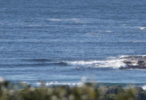
Hello Friends, Sunny skies over Sydney this morning and around 10-15 kts of WSW wind fanning a waist to chest plus south swell. It’s about 2 metres out at sea and was 10 seconds apart as of 0600. There were a few bods in the water at Dee Why point chasing what looked to be […]
Friday late, photos of an arriving swell?
One last photo post for Friday. I stopped by Longy, Curly and Dee Why for a few snaps just before the light drained away on Friday. Swell was looking like it could be solid by tomorrow, but the energy was looking straight south. So, while Longy and Curly were showing head to head and a […]
Clean looking start to the day
Hello Friends, Beautiful start to the day. Light offshore wind, mostly clear skies and a small but clean looking south line pulsing in. The MHL buoy data tells us it was south, 2 metres at 9 seconds as of 0500. Tide was dropping to the low at 0850 and, as you might expect, the point […]
Messy and small under grey skies
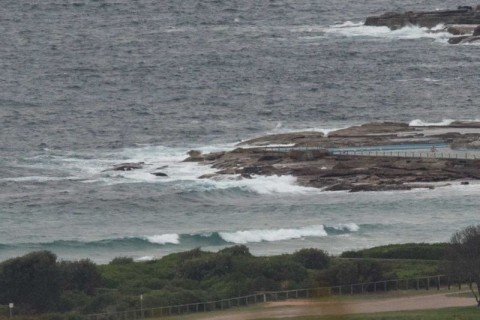
Hello Friends, Steady ESE wind as of 0700 and it’s not making a pretty picture where Dee Why’s concerned. A couple of hours earlier, the MHL Sydney buoy was registering 2 metres of 9-sec S-SSE wind swell. So it’s not totally flat, but that onshore is making a mess of it. Tomorrow and Saturday look […]
Faded rapidly but not flat

Hello Friends, At 0600 swell was 2 metres at 9 seconds apart from the south and wind was light westerly under overcast skies. We can expect the wind to come around to the SE later. Tide is dropping and today’s low will be at 0930. Swell direction, size and period aren’t optimal for Dee Why, […]
Wet but not flat
Hello Friends, RealSurf HQ totally socked in with rain this morning, so waited until I’d done the Manly run to post. Swell has come up significantly from yesterday’s flatness. And wind was light early if you didn’t mind the heavy grey and rainy skies. Grabbed my first shot at South Steyne where a solitary optimist […]
Inbound swell
Hello Friends, We have a mix of swell this morning. The main energy is from the south at a couple of metres with an average period of about 9 seconds, but there’s a metre or so from the NE at about 8 seconds. Wind is out of the WSW at 10-15 kts for now, but […]
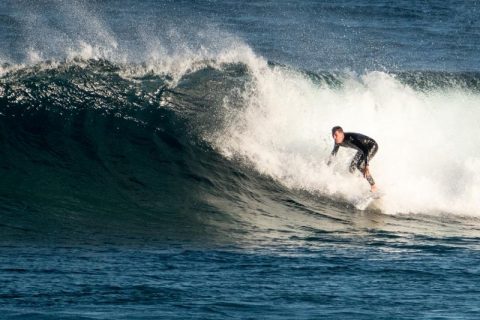
Catchables to be had
Hello Friends, Get in early at your fave south spot or miss out seems to be the message from the forecasts today. An incoming tide, light wind, and a couple metres of 9 second period south swell were combining to produce waist to chest plus waves along the beach at Dee Why. There doesn’t seem […]
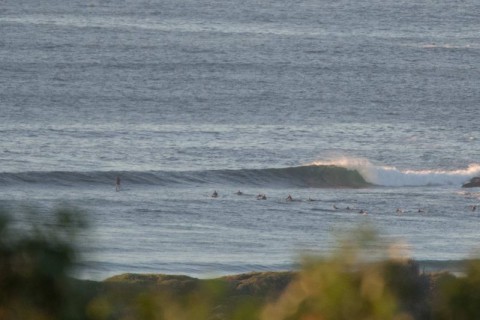
Looking good this morning
Hello Friends, Light offshores, around two metres of 9s south swell and sunny skies. What more could you want? Sets at Dee Why are still occasionally getting into the shoulder high plus range but they’re getting further apart as the swell slowly weakens. Get out there if you can and have some fun! […]
Looks unflat to me
Hello Friends, Hello Friends, Dee Why beach was well populated by 0800 this morning as keen surfers made the most of what is likely to be a realitively br4ief south pulse for International Surf Day. The MHL buoy is showing 2 metres of 9 second period straight south swell. That should mean that the […]