Small lines, small waves
Hello Friends, At 0500 the Sydney MHL buoy was showing 1.5m of 9-sec SSE swell. A little before 0700 Dee Why point was picking up what looked to be the odd knee to waist set – although nobody was in thew water at the time. Up the beach there were similar size options. I grabbed […]
Down another cog but still a few about

Hello Friends, Following the trend set firmly in place yesterday, this morning sees conditions distinctly smaller again. The swell’s fading away, but this morning’s first shift was still picking up the odd chest high wave face up the beach and the occasional waist high little runner along the rocks at the point. As of 0700 […]
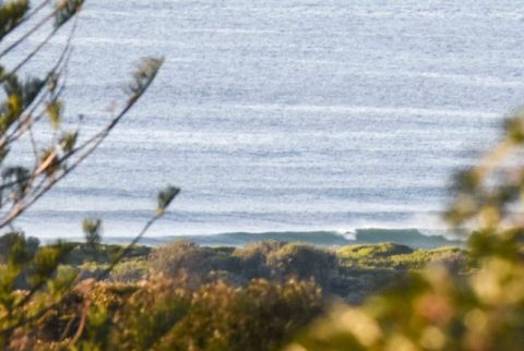
You’ll need to be keen
Hello Friends, About 1.5 metres of 9 second period south swell this morning. First high tide of the day is 0930, so when I took the picture above it was pretty fat and full. Not much wind about, but the forecast is calling for NE of 10-15 kts later. So maybe as the tide drops […]
Small surf Sunday
Hello Friends, Another smoky start for Sunday, but there is still a little south bump making its way in. Nothing too amazing really. Sets are around the waist high mark, so it looks to have dropped a little from yesterday morning. Reasonable number of folk in, not surprising really given the prospect of mainly sunny […]
Looking less than wonderful to start
Hello Friends, One of those murky, drizzly mornings we’ve come to expect from this summer. Swell is about a metre and a half from the SSE at about 9 seconds. So, it’s not flat. Wind is light from the SSW as I write this around 0830, but the forecast tells us it’ll be onshore from […]
No Mondayitis in Dee Why this morning
Hello Friends, Looks like we’ve got one more morning of waves. Swell has slipped down another cog, but it has a touch more east to the direction and size at sea is averaging around 1.5m at about 9 seconds. This is delivering shoulder high sets (and the odd bigger one) up the beach at Dee […]
Small but surfable this morning, bigger later?
Hello Friends, “Large swells breaking dangerously close inshore” always catches a surfer’s eye and that’s what the Bureau was saying last night and again this morning in its marine forecast for the Sydney region. But look at the fine print and you can understand why it was only about waist to chest high along the […]
PICS: Sth Curly, Fri morning fun
Friday morning kicked off with sunny skies and a little swell left over from the day before. I ended up at South Curly late in the morning after having checked Avalon, Newport, Mona Vale, North Narrabeen, Long Reef and Dee Why without finding anything as good. Wind was offshore and every now and then a […]
Close of play, Friday
Hello Friends, One of those days when I was checking it every hour or two, hoping the swell would perk up. The swell size at sea didn’t vary much today, but the average period did increase from less than 8 seconds this morning, to almost 10 this afternoon. Should be cloudy tomorrow, but with lighter […]
Looks like some little fun ones
Hello Friends, Looks to be around the waist high range at the south end of Dee Why beach. There’s a touch more east to the swell which is now averaging around the 1.5 metre mark at about 9 seconds apart. Should have some pics up later as I’m heading out to grab a few now. […]