Hello Friends,
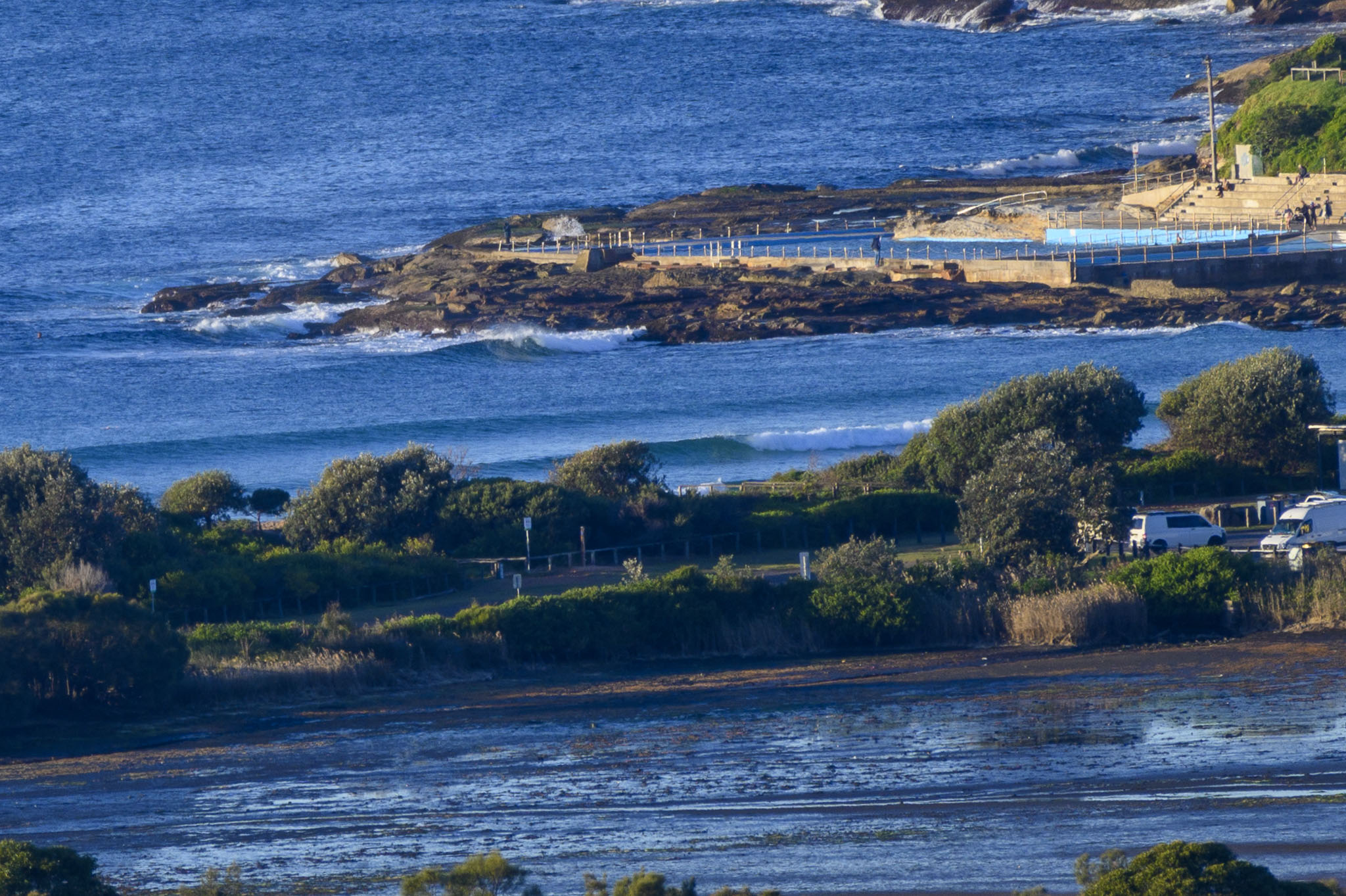
Should be a nice sunny day for us, but waves remain exceedingly small. Swell at sea was 0.8 metres from 155° at 11 seconds. That means maybe waist high on the bigger sets at the best exposures, but tiny to flat everywhere else. Tide was low at 0725 and will be back to a modest 1.3 m high at 1335. As of 0750, wind was out of the NW at 5-7kts. We’re heading to a high of 19C today – which also happens to be the current ocean temp.
Swell doesn’t look like improving today, but it should be a bit bigger and more southerly tomorrow. It’ll be interesting to see what the Goat makes of the weekend prospects. He’ll drop his forecast this afternoon, so be sure to check back for your weekly dose of surf wisdom.
Have a great Thursday one and all.
Weather Situation
A cold front will clear from New South Wales coastal waters during Thursday morning, bringing a fresh to strong west to southwesterly wind change for Thursday and Friday.
Forecast for Thursday until midnight
Strong Wind Warning for Thursday for Sydney Coast
- Winds
- Westerly 20 to 30 knots decreasing to 15 to 25 knots in the middle of the day then increasing to 20 to 30 knots in the evening.
- Seas
- 1 to 1.5 metres, increasing to 2 to 3 metres offshore.
- Swell
- Southeasterly around 1 metre.
- Weather
- The chance of a thunderstorm offshore early this morning. Mostly sunny day.
Friday 18 June
- Winds
- Westerly 15 to 25 knots tending west to southwesterly 25 to 30 knots in the evening.
- Seas
- 1.5 to 2 metres, increasing to 2 to 3 metres by early evening.
- Swell
- Southerly 1 to 1.5 metres.
- Weather
- Partly cloudy. 70% chance of showers. The chance of a thunderstorm offshore.
Saturday 19 June
- Winds
- Southwesterly 30 to 40 knots tending southerly 30 to 35 knots during the day.
- Seas
- 3 to 4 metres.
- Swell
- Southerly 1 to 2 metres, increasing to 3 to 5 metres during the morning.
- Weather
- Cloudy. Near 100% chance of showers. The chance of a thunderstorm.


