Aw Huey, where’d the waves go
Hello Friends, Yesterday’s little pulse faded away overnight and this morning started out drizzly with light wind. The MHL data was showing a metre of 8-sec SE wind swell. As the pictures show, there really weren’t any waves to speak of at the Dee Why end of the beach. If you’re really keen, you might […]
Not a manic Monday
Hello Friends, Tide was low at 0450 and is now coming into the high at 1105. Not that it matters. It was too small to attract any surfers to Dee Why that I could see. The MHL buoy was showing a metre of 8-sec SSE bump at 0600, so you might possibly get a knee […]
Tiny lines hint at a possibility or two
Hello Friends, Swell has come up just a touch from yesterday. The MHL buoy was showing a metre of 8-sec SSE windswell and wind at North Head was out of the west at 10 kts as of 0750. Tide will be high at 0845. There were no takers at the point – unsurprisingly – but […]
Very small on Monday morning
Hello Friends, In line with yesterday’s forecast, Monday morning sees a metre of 8 second SSE swell out at sea and maybe a third of that at Dee Why. Surface conditions were smooth at 0700 thanks to a light NNW breeze. Skies were clear. Next tide is a high at 0840. Outlook is for the […]
Warm from early

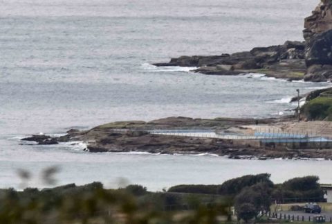
Hello Friends, 28 degrees at 0800 on a sunny Sunday morning with only a faint NW breeze. Ocean was looking utterly micro at Dee Why as we headed toward high tide at 0820. Only the odd ski paddler to be seen off the beach. The MHL Sydney buoy wasn’t working, but I’d have to think […]
Micro Monday at Dee Why
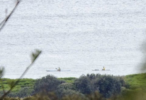
Hello Friends, The first full day of the We’re RealSurf crowdfunding drive and not a wave to be seen. C’mon Huey, help us out here mate! This is supposed to be a surf report and I don’t have any surf to report. Instead there’s maybe a metre of SSE wind swell which is barely registering at Dee […]
Little lines for the early
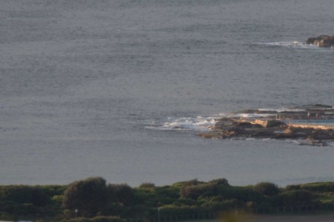
Hello Friends, Not much happening this morning, but at least there’s a little something for the keen. At 0700, Dee Why was showing sets into the waist high plus range along the beach – but nothing at the point. The MHL buoy data indicates a SSE swell of about a metre with an average period […]
Sunday rolls slowly along
Hello Friends If you are extra keen, there should be some tiny knee to waist high lines about the place. But don’t expect to see the bigger ones too often, particularly as we start to see the high tide take effect (it peaks at 1415). This morning saw light northerly wind and about a metre […]
A last little trickle
Hello Friends, The little pulse of south-east wind swell over the weekend has weakened away to about a metre at sea. At Dee Why this resulted in the very occasional waist high set as the day got started. Outlook is for the waves to weaken away to pretty much nothing by tonight. I didn’t get […]
Hot and tiny…for now
Hello Friends, This morning’s forecast tells us we can expect it to get up to 36 before a south change develops in the afternoon. From the cast of the latest models it would seem that we’re not likely to see much in the way of wave action this afternoon. It looks as though the peak […]